Chinese Academy of Sciences researchers have successfully field-tested a new unmanned, vehicle-mounted glacier penetrating radar that captured high-resolution images of a glacier’s interior, achieving a 100% data acquisition rate over tens of kilometers.
The autonomous system, tested on the Bayi Glacier in October 2025, penetrates over 100 meters of ice, providing crucial data on the “Asian Water Tower’s” water reserves with remarkable efficiency and accuracy.
Imagine trying to map a massive, moving river of ice from the inside out, in some of the planet’s most hostile environments. This is the monumental task glaciologists face, and it’s exactly the challenge a team from the Chinese Academy of Sciences (CAS) has tackled head-on.
Their solution? A groundbreaking unmanned radar system that just completed its first successful field deployment, promising to revolutionize how we monitor the world’s icy sentinels of climate change.
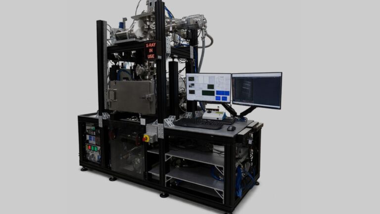
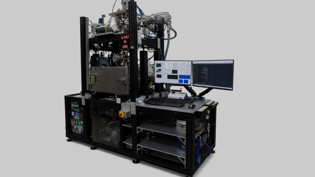
So, how does this technological marvel work? Developed by the State Key Laboratory of Remote Sensing and Digital Earth in collaboration with the Laboratory of Electromagnetic Radiation and Detection Technology, this isn’t your average radar.
READ ALSO: https://www.modernmechanics24.com/post/cambridge-lab-nano-antennas-electrical-boost
It features a novel, low-power digital design, reported CAS. This clever engineering allows it to conduct high-precision, fine-scale measurements of glacier thickness while sipping power compared to conventional systems. Think of it as a high-definition MRI scanner for glaciers, but one that operates completely autonomously in the freezing, thin air of high altitudes.
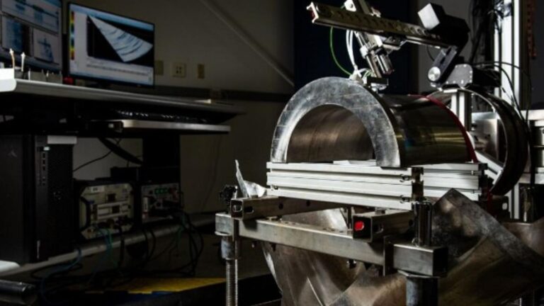
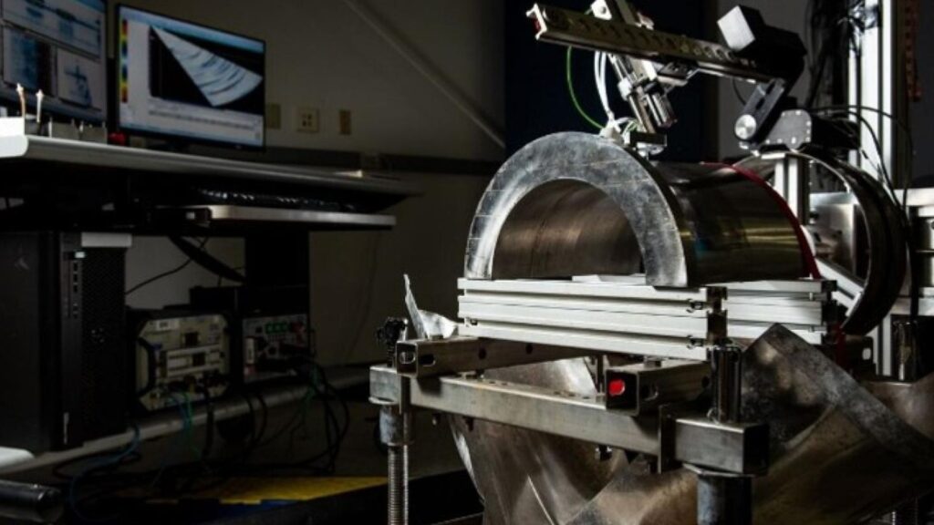
The proof, as they say, is in the pudding—or in this case, the pristine ice of the Qilian Mountains. During an intensive field campaign between October 10 and 25, 2025, the team put their creation through its paces on the Bayi Glacier. The results were stunning.
The system conducted surveys across tens of kilometers with measurement intervals down to the millimeter scale, according to the research team. It consistently penetrated more than 100 meters of solid ice, returning crystal-clear images of the critical boundary where ice meets bedrock and revealing the hidden topography of the subglacial terrain.
WATCH ALSO: https://www.modernmechanics24.com/post/xlaserlab-e3-uv-game-changing-engraver
Why does seeing this hidden world matter so much? The data is vital for accurately assessing the volume of water stored in glaciers, which are often called the “Asian Water Tower.” This system’s performance marks a “significant improvement in detection efficiency, data accuracy, and energy performance,” stated the researchers.
Beyond just being a technical achievement, its proven reliability in extreme conditions means it can support the long-term, continuous observations scientists desperately need to understand the pace of glacial melt.
The choice of the Bayi Glacier as the test site was no accident. As the largest glacier in the headwaters of China’s second-largest inland river, the Heihe River, it’s a hydrological heavyweight.
Stretching 2.2 kilometers and covering 2.81 square kilometers at elevations between 4,520 and 4,828 meters, it serves as a perfect natural laboratory. The successful deployment here demonstrates that the technology can handle the rigors of real-world, large-scale glacier monitoring.
READ ALSO: https://www.modernmechanics24.com/post/aim9m-sidewinder-israel-anti-drone-mods
Ultimately, this breakthrough is about more than just impressive engineering specs. It enhances both the efficiency and spatial coverage of glacier monitoring, providing the key data on glacier thickness and subglacial features needed to manage water resources for millions and protect fragile alpine ecosystems. In the fight against climate change, knowledge is power, and this unmanned radar gives scientists a powerful new tool to see the future written in the ice.